
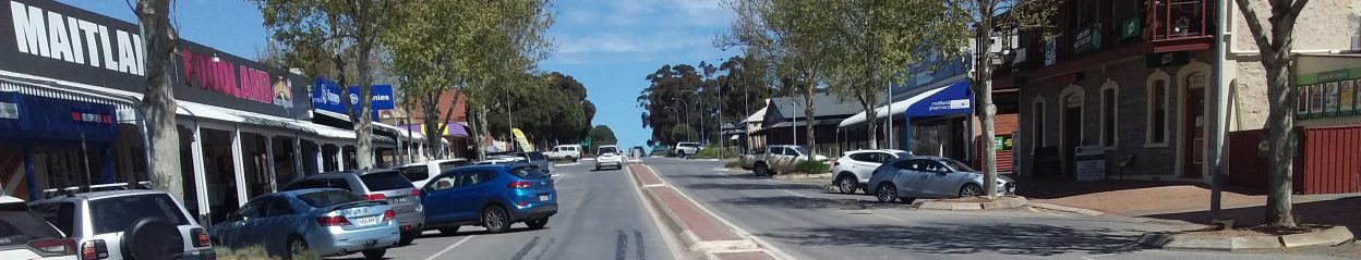

The main page of this website addresses the ongoing problems created by the Plane trees planted down each side of the township’s main street, its busiest street, Robert Street. The trees have adorned the street for around 25 years and they certainly provide appeal and ambience to the streetscape in summer, but at considerable cost to the community in terms of danger, damage, and nuisance. At this point in time the trees, at around 10 metres high are only half their mature height of 20 metres with a 10 metre canopy.
Many people in the community recognise that the trees have been badly sited, which at the time of planting reveals a woeful ignorance, or disregard for information that was available, emphasising the damage they could do to existing property and infrastructure. This by employees of the Council’s Engineering Department who should know better.
Tree Risks in the Streetscape
In terms of risk management the harm caused by the trees outweighs the benefits they provide, as follows:
Leaves
Fallen leaves block the gutters of neighbouring buildings on the street;
Fallen leaves when unmanaged enter and litter premises on the street;

Excessive leaf litter May 2017 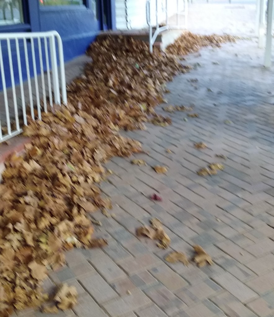
Leaf litter “Drift” May 2017 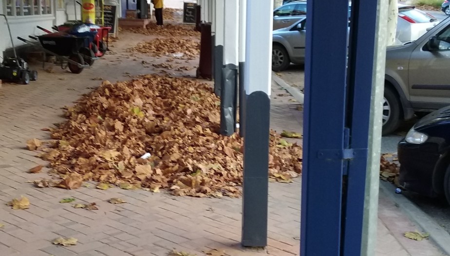
Unmanaged leaf litter May 2017
Note: Double-click on any picture to enlarge.
During the first-flush of a storm loose leaves accumulate and block the street gutters and side entries, resulting in localised flooding, which in some instances has been quite detrimental;
Leaf litter after removal from side entry opening. 
Narrowing of gutter near tree T8 forces water up the footpath leaving slippery deposits. 
Leaf buildup in background. The tree surround forces the flow up the footpath making it slippery. 
ANZ carpark after Robert St flood water had diverted through it to exit at the side of 30 Elizabeth Street.
Wet leaves on footpaths are a slipping hazard particularly for the elderly majority of the town who are not as steady on their feet as when they were younger. A number of falls are known to have occurred in the community, some causing injuries. Seemingly few have been reported because of the past reluctance of council to do anything constructive about the problem, beyond rush out and remove the leaf, lump or hollow identified, so as to mitigate compensation claims?
Roots
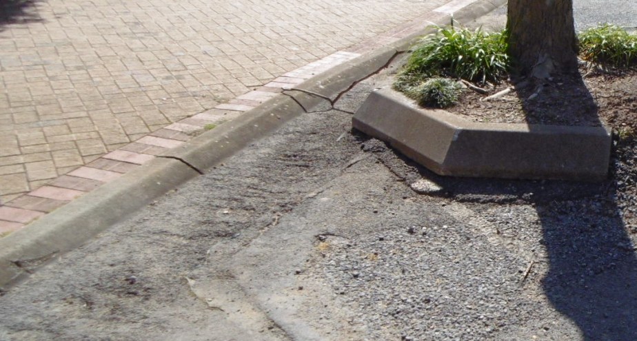
Large surface roots lift and fracture kerbs, buckle footpaths and render the innate act of walking risky;

Roots of T12 grown into Post Office drainpipes lifting the kerb, buckling the pavers and blocking the gutter. 
Aggressive root damage to kerb and pavers creating a serious tripping hazard at tree T20 next to the Maitland Hotel. 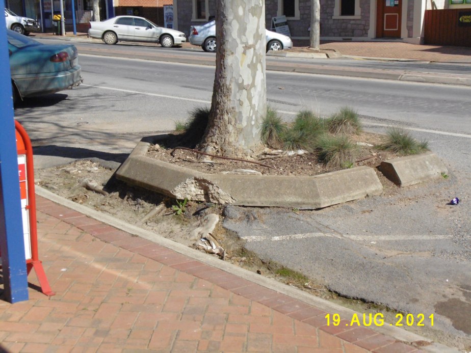
T10 tree ring lifted above road level by a 100mm diameter root going under footpath searching for water. 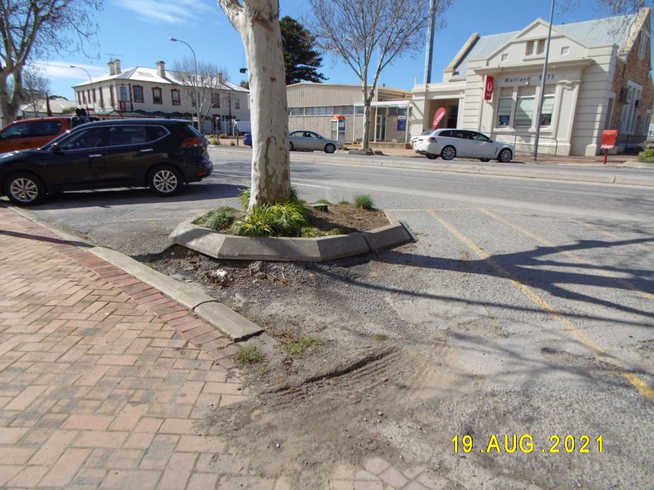
Tree T5 raised surround, raised kerb showing cursory repairs, undulating pavers and footpath fouled with detritus. 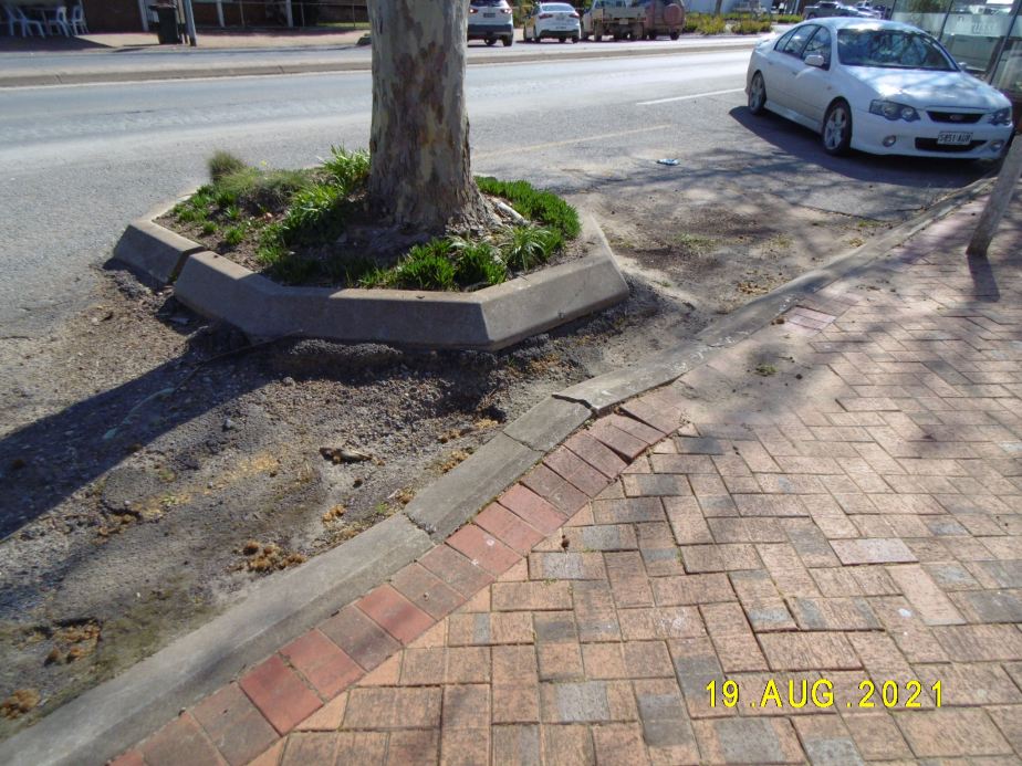
Extensive damage to road surface, gutter, concrete kerb,and footpath around tree T22
Building Damage
The trees at around 10.0m in height are of a size that their roots will be invading the footings and services of nearby buildings.
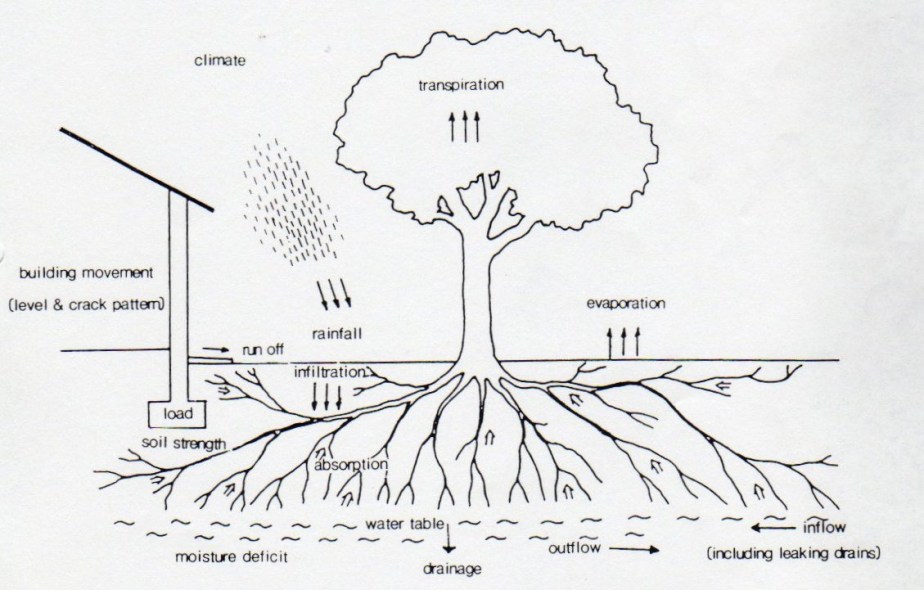
Tree growth moisture cycle 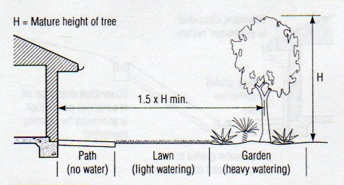
Recommended tree distance to minimise tree drying effects in expansive clay soils.
It has been universal knowledge for decades that trees planted closer than 1.5 times their mature height from masonry may cause damage. A matter with which technical staff of council have been well acquainted for many years, when approving building applications?

Sandbagging at 30 Elizabeth Street to stop water and gravel from the ANZ car park entering the property. 
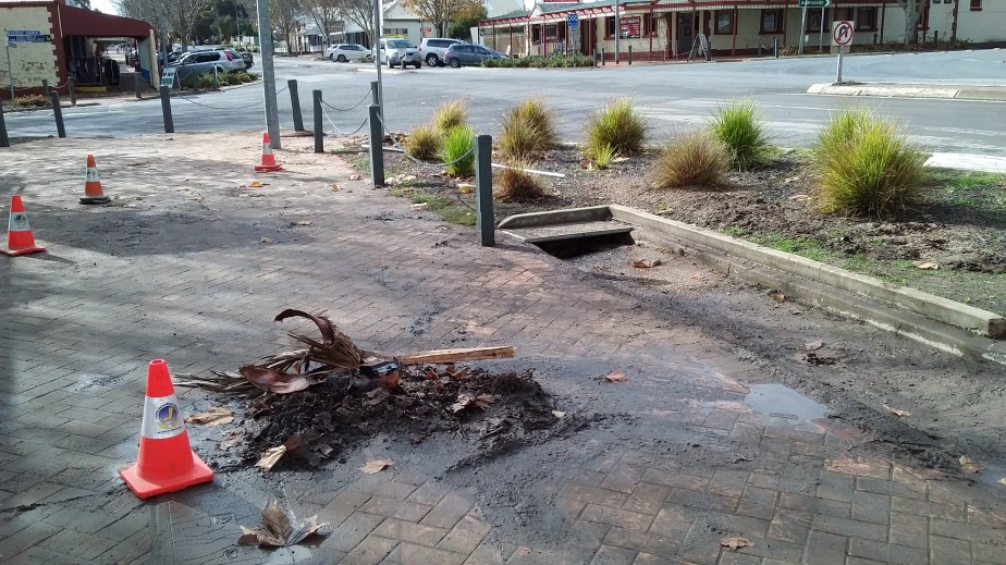
Plane tree on the corner of Elizabeth St removed for blocking the Telstra drains. 11/8/2021, 
Telstra corner after tree removal and new culvert constructed up to Robert Street.
Pipe Damage
Their is a conspicuous history of burst water mains down both sides of Robert Street. The damage is known to be caused by the roots of the trees crushing and invading the pipes. Council must have been aware of the problems to be expected when planting the trees near the underground pipework. The primary reference currently is the SA Water Tree Planting Guide whilst a similar guide was available prior to 1995 published by the then E&WS.

How roots invade or crush ceramic or fibre reinforced cement (FRC) socket and spigot pipework. 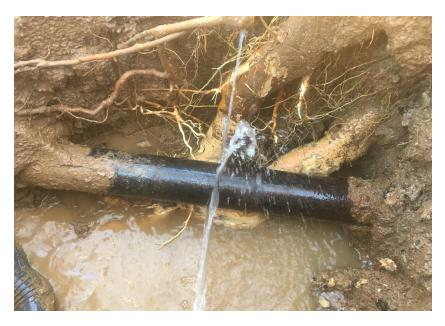
Figure from the SA Water “Tree Planting Guide” clarifying the damage done to water pipes by tree roots. 
Invasion of drainpipes by tree T12 roots, buckling the kerb, footpath and reducing the gutter flow.
Any idea that council weren’t aware of the pipes is untrue because it is their responsibility to know the location of any third party services within the town infrastructure. That aside even today it is easy to identify the locations of the water main’s from the inspection covers visible in the roadway, clearly indicating the line of the water mains is below that of the trees, (see the photos below).

Water main access covers (V3) opposite the bakery showing trees above the main. 
Access cover for water main (Access V1) in front of bakery showing the treeline to be over the main.
On the 13/2/2017 the 150 water main in front of 23/25 Robert Street was fractured by Plane tree roots. This not only interrupted and contaminated the town water supply but also caused extensive flooding of the roads and properties along Robert Street, Elizabeth Street and Maitland Terrace some 600m away. The path of flood is depicted in blue, on the satellite photo below:

As a result of the tree surrounds obstructing the gutters, water overflowed onto the footpaths in familiar places, such as in front of Foodland, the Newsagents and the Post Office. The water was forced across the median strip by the intensity of flow, to collect in front of the ANZ Bank because the entry to the Elizabeth Street culvert was choked. The water backed up until able to bypass the Bank through its carpark to exit along the side of 30 Elizabeth Street.
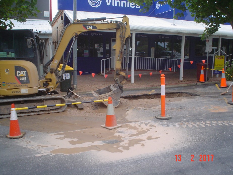
SA Water repairing 13/2/2017 burst (R1). Pipe bedding and trench fill ejected down the street. 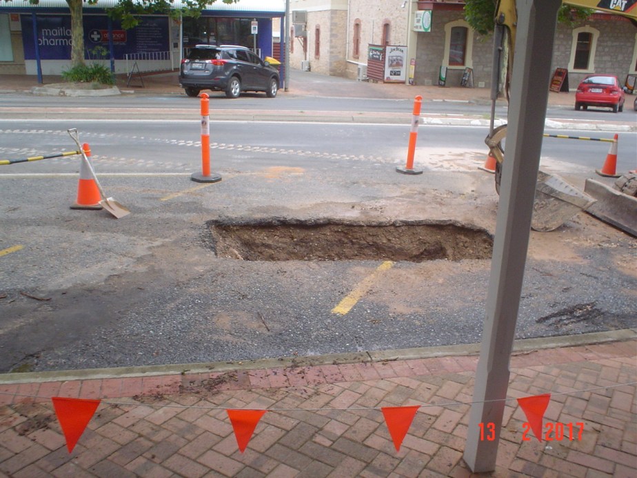
13/2/2017, burst Water main (R1). Tree roots crushed the pipe. flooding the town. 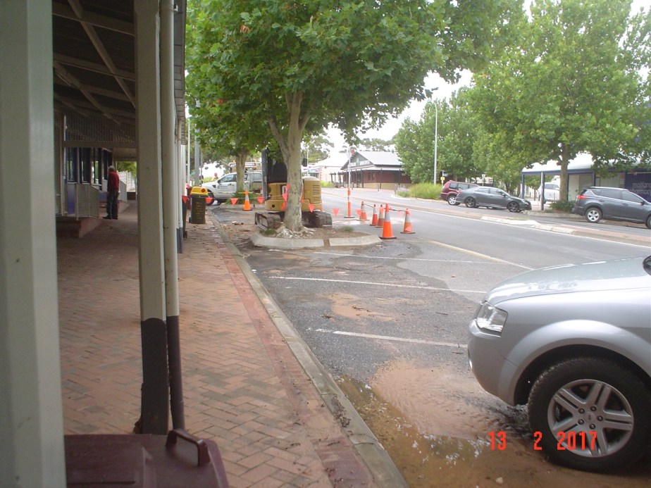
SA Water repairing 13/2/2017 burst (R1). Trench fill littering the street.
The flow was then able to continue down Elizabeth Street where the intensity at its peak ripped up the kerbside bitumen, exposing the underlying rubble and reinforcing mesh. The junction with Maitland Terrace was inundated as the flow diverted south along the Terrace to the low point in front of No. 11, before crossing the road to enter the parkland drain to the retention pond on Tiddy Avenue.
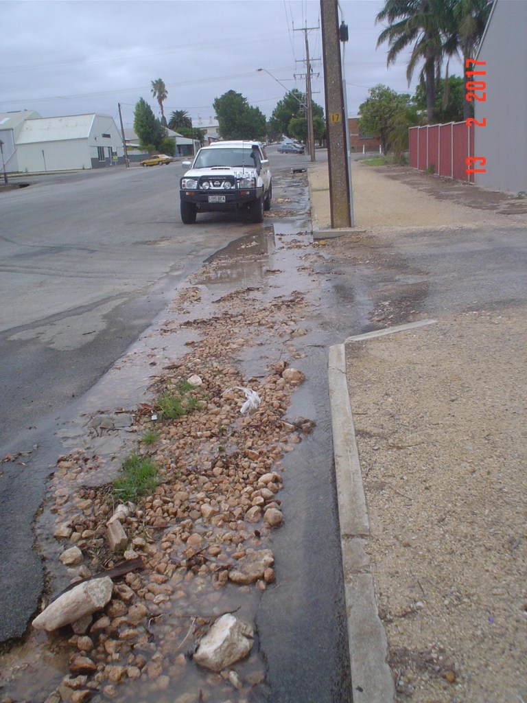
Damage to the road around 400m away on Elizabeth St, where the intensity of flow from the burst ripped up the bitumen. 
Aftermath of the burst 500m away at the junction of Elizabeth St and Maitland Tce . 
11 Maitland Tce road damage due to water collecting in front of driveway. 
The front of 11 Maitland Tce, 600m away from burst, where water collects and diverts into the retention pond.
Some three months later a camera survey of the culvert under Robert Street was undertaken on the 25/5/2017, confirming the culvert was partially blocked by small rocks and debris after which the culvert was flushed clean.

CCTV specialist hired to inspect and unblock the culvert under Robert St. 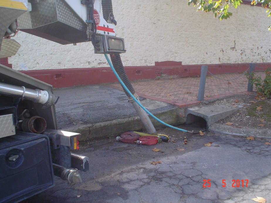
Flushing one of the Elizabeth street culverts under Robert Street. 
Drain clearing vehicles 25/5/2017 
A CCTV pipe inspection of the culverts below Robert Street on 25/5/2017. The half grown Plane trees on each corner clearly next to the drains 
Plane tree on the corner of Elizabeth St removed for blocking the Telstra drains. 11/8/2021,
Some time later in August 2021 the Plane tree on the corner was removed along with a portion of culvert pipe, because the roots were blocking drainage from the Telstra building.
Loss of Parking
One further aspect of the poorly managed tree planting of Robert Street is that each tree surround exists at the loss of one badly needed parking bay. This amounts to at least 22 more parking bays that could be provided on this main street if the trees had not been planted or if removed.
It needs to be noted that this vexed issue of parking spaces repeatedly thwarts main street development proposals by the dogmatic application of The Building Rules by council planners. This issue is a matter for a later review of what council understands by verbose strategies like – “Facilitate improved township amenity through good urban design” an ambiguous statement to support them in doing nothing?
What’s to be done?
Having explored the anatomy of a burst influenced by the trees and the impact on the community it begs the question – “what can be done?”
The most cost effective course of action would be to remove the trees, re-seal the roadway, re-lay the footpath and find a more contemporary solution for shade and decoration of the streetscape. When letting a contract though it is imperative that comprehensive design documentation is produced to ensure that all renovated infrastructure complies with current standards for stormwater drainage and people friendly pavement grades, preferably in line with the State governments Water Sensitive Urban Design strategy implemented some 10 years ago, and enthusiastically embraced by most councils.

Traditional bullock train 
Coach and Horses in front of Telegraph Office
This would be in contrast to the 2017 bodgy contract issued by this council for new paving, using phrases like “all work to match existing”. A strategy meant to minimise expenditure but clearly one to perpetuate our 19th century infrastructure, created for horse and cart, and bullock trains, but not the prevalent 21st century traffic.
Typical semi-mountable kerb with paving. 
Geometry of the existing kerb type. Ref: SA-Infrastructure-Guidelines – Standard Drawing SD100C
Another contributor to street flooding is the use of the semi-mountable kerb. The low profile of this type of kerb reduces the available gutter depth by 25mm, so that the run-off from a significant storm has to swamp the pavement to get the extra depth needed until the flow reduces. The dimensioned drawing above is taken from a document called the Infrastructure Guidelines SA Rev1 a document produced by the The Institute of Public Works Engineering Australasia (IPWEA) and is readily available to those who don’t have technically qualified staff. Some rural councils such as the Light Regional Council have adopted the Infrastructure Guidelines SA which was released for use in December 2016. The Development Departments of more affluent councils like the City of Salisbury have produced their own version of the Infrastructure Guidelines, whilst acknowledging the above source.
Furthermore the flooding of the footpath in front of the ANZ bank whilst due to the low kerb is worsened by the excessive cross camber in the carriageway at that point, which is much steeper at 1:11 (110mm in 1220mm) than the usual 1:30 thus requires an increase in width from the pavement to accommodate the flow.

Kerb level view of the steep cross-slope in carriageway in front of the bakery. 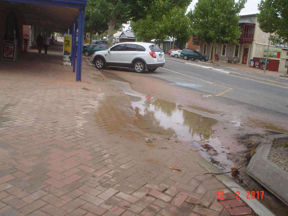
Residual ponding and sand near Newsagents from burst. Typical after heavy flows down the street! 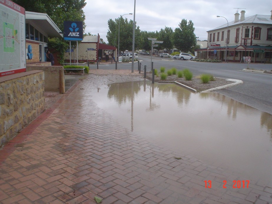
Elizabeth St culvert blocked,during the burst. More water on footpath than carriageway due to kerb and camber. 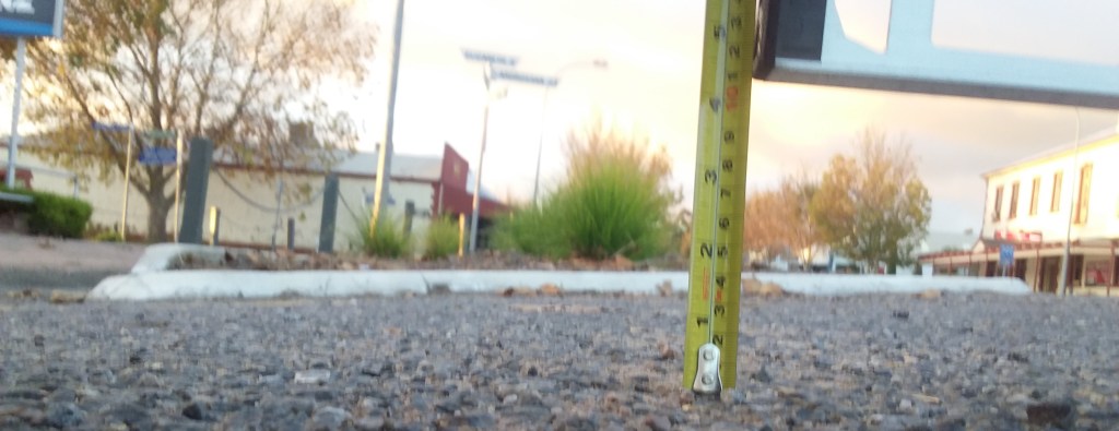
Measuring carriageway cross camber in front of ANZ. Slope of 1:11 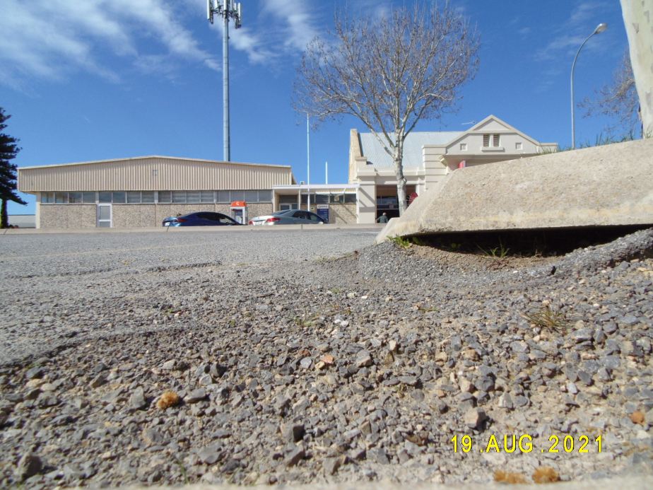
Kerb level view of the steep cross-slope in carriageway in front of the ANZ.
These days there seems to be a general reluctance to remove trees, particularly those of significance however this Council clearly has no qualms when it suits their agenda as evidenced by an historic examination of the council office surrounds and their Elizabeth Street approach .

Elizabeth St Council office before trees were removed. 04/02/2016 
Elizabeth St Police Station before the trees were removed. 01/02/2018 
Telstra corner after tree removed. 25/09/2021 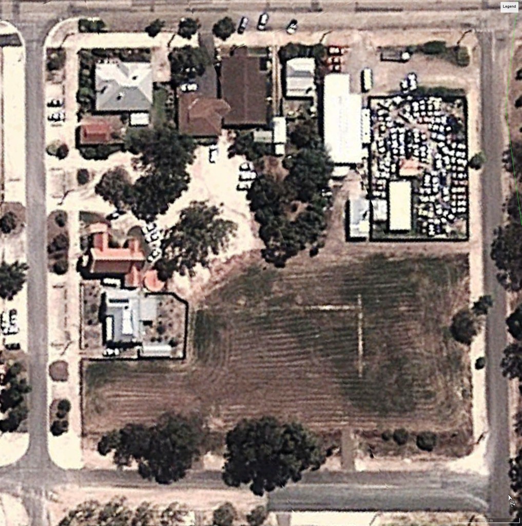
2012: Old Council Office with trees visible both font and rear. 
2020: New Council Office surrounds now devoid of trees.
The purpose of this last observation is to point out that there is a precedent for wholesale removal of trees in a particular locality.
